
While Oklahoma may be a comparatively young state, it’s nonetheless rich with history, lore and fun facts. Unfortunately, some of those facts aren’t quite so … factual. In this new series, M.J. Alexander hunts for the accuracy – or lack thereof – behind some of our state’s stories.
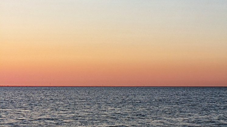
The Claim: Oklahoma has more shoreline than any other state.
Source: USA Fact File: usacitiesonline.com/usafactfile.htm
Fact Check: This may be the most frequently repeated myth about Oklahoma. Although the state is one of 20 that have no shoreline on either an ocean or one of the Great Lakes, the claim keeps circulating because of the lack of a single national database that totals all types of shoreline, and differences of opinion on what counts as shoreline and how it is measured.
According to the National Oceanic and Atmospheric Administration, the state with the most shoreline is Alaska, with 33,904 miles. Second place is Florida, with 8,436 miles of coastline. Third is Louisiana’s 7,721 miles.
The Oklahoma argument for claiming more shoreline than any other state is along these lines: Sure, we have no ocean or Great Lakes frontage, but we have a lot of lakeshore!
The Oklahoma Water Resources Board notes that Oklahoma has approximately 3,000 lakes and ponds 10 acres or more in size, including more than 200 man-made lakes. The OWRB lists 55,646 miles of shoreline along lakes and ponds. (Even within the state, there is disagreement on the numbers; the Oklahoma Department of Wildlife Conservation claims the state has 11,600 miles of shoreline.)
A major flaw in this argument is that it does not take into account that every other state also has interior lakes. Minnesota, for example, counts 11,842 lakes sized 10 acres or larger, compared to Oklahoma’s 3,000. And according to the Alaska Department of Fish and Game, Alaska has 3 million lakes of 5 acres or more, many of them seasonal snowmelt.
Boosters point out that Oklahoma boasts 1,401 square miles of water area in its lakes and ponds. Which is great … but by way of comparison, the largest of the Great Lakes, Lake Superior, measures 31,700 square miles.
But wait — not so fast! Oklahoma also has thousands of miles of rivers and streams. Be sure to count them!
The INDUS Corporation, under contract with the U.S. Environmental Protection Agency, has done just that. Its 2012 survey mapped 150,022 miles of linear rivers and streams in Oklahoma. More than three-quarters of them – 77 percent, or 115,611 miles – are classified as “intermittent or ephemeral flow,” containing water only part of the year or after heavy rains. The OWRB comes up with slightly higher numbers, listing 167,600 miles of rivers and streams. The Oklahoma Department of Wildlife Conservation claims 78,500 miles of rivers and streams.
Regardless, the INDUS survey finds that other states contain even more streams and rivers. Texas, for example, has 1,589,190 miles of rivers and streams, with 29 percent (454,453 miles) intermittent or ephemeral.
Sometime after the state’s mid-century building boom of man-made lakes, it is likely that an Oklahoma booster added the miles of shoreline of the state’s ponds and lakes and rivers and streams, realized that the total was more than any other state’s seashore and greater than that of the Atlantic Coast (28,673 miles), Gulf Coast (17,141 miles) and Pacific Coast (40,298 miles) – and declared Oklahoma the champion of all, a claim that has been passed on in conversation, guidebooks and school worksheets ever since.
However – sorry to burst our state’s watery bubble – it simply isn’t so.
Playing the Percentages
Another big-picture measure of the prevalence of water in each state is offered by the U.S. Census Bureau. Its 2010 survey calculated the total land area and water area of each state, including inland and coastal water.
Oklahoma ranks 35th among the states, with its surface divided between 1.9% water and 98.1% land, far below the national average of 7% liquid.
PERCENTAGE OF WATER SURFACE VS. LAND
Highest
Michigan 41.5%
Hawaii 41.2%
Rhode Island 33.1%
Massachusetts 26.1%
Maryland 21.8%
Delaware 21.7%
Florida 18.5%
Louisiana 17.5%
Wisconsin 17.3%
Lowest
Oklahoma 1.9%
South Dakota 1.7%
Indiana 1.6%
Missouri 1.4%
Idaho 1.1%
Montana 1%
West Virginia 0.8%
Iowa 0.7%
Nevada 0.7%
Nebraska 0.7%
Wyoming 0.7%
Kansas 0.6%
Colorado 0.4%
Arizona 0.3%
New Mexico 0.2%