Infrastructure upgrades allow more residents to live without their cars.
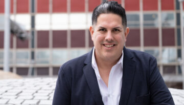
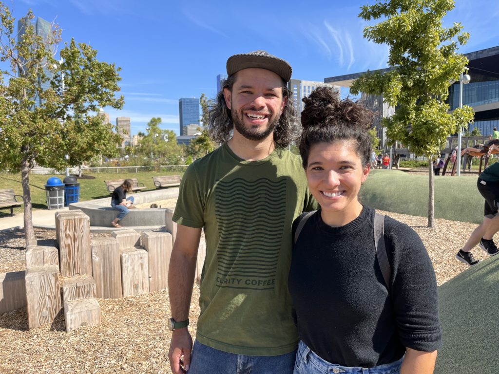
In July, Caleb and Abby Savage sold their only car. The decision wasn’t uncalculated or uncharacteristic for the couple; Caleb had already been routinely biking and busing from their home near Capitol Hill to his job as a manager at Clarity Coffee downtown.
“I’ve never enjoyed cars,” he said. “I can’t understand them, I don’t like them and I don’t want to have one.” Still, he and Abby had purchased a used car in 2019 before having their daughter.
Abby more regularly drove the family car, to her job as a school teacher and to grocery stores in Moore. But when she saw a family using a cargo bike, which is an electric bicycle with containers that can hold a load of groceries or young passengers, it convinced her, and Caleb, to finally go car-free.
“We have some kids in our neighborhood that were like, when we sold our car, ‘Why are you doing that?’” Caleb said. “Are you kidding? We saved $300 a month.” However, their reasoning for replacing their car with a cargo bike was more than just cutting gas, insurance and maintenance costs. The switch meant they could no longer effortlessly breeze through miles of neighborhoods across the city to try the newest restaurant, or go on impromptu runs to large retail chains like Target. Instead, they slowed down. They purposefully confined their world to their immediate neighborhood as a way to feel more grounded in their community.
“It’s the same desire of being tied to your place and (setting) healthy limits within yourself, because we’re not limitless beings — and we shouldn’t try to be,” Abby said.
Over the past few decades, the concept of “walkability” has taken hold of city governments and residents alike. Walkability is defined as the degree to which a city is safe, comfortable, convenient and enjoyable to walk in as a primary mode of transportation. Many factors contribute to creating a walkable city: reliable and accessible public transit, neighborhood density, street design that reduces driving speed, bike lanes, sidewalks, etc.
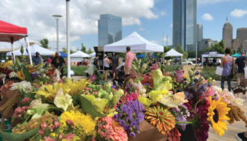
Daisy Muñoz, the vice chair of the MAPS 4 Connectivity subcommittee, believes walkability can greatly shape how a community interacts. “If you’re in cars all the time, then you never really get to say hi to one another,” she said. “But if you’re able to walk down the street to your grocery store or a park, you’re able to say hi and know your neighbors, which then also creates more vibrant, safer neighborhoods.”
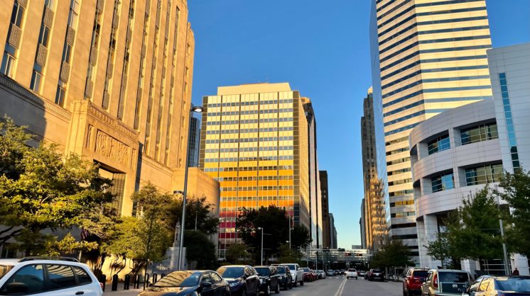
Carless cities might conjure images of dense coastal metropolises such as New York and San Francisco. But since the late 2000s, Oklahoma City has slowly made steps toward improving its walkability. It started with repaving downtown streets and has expanded into upgrades to sidewalks, bus stops and bike lanes in neighborhoods across the city.
According to Walk Score, which calculates a city’s walkability by how many daily errands can be done on foot, Oklahoma City’s downtown is now “very walkable,” with a score of 72. However, downtown is only a fraction of the city’s 621 square miles. Oklahoma City as a whole still has a walk score of 34, which marks it as a firmly “car-dependent city.”
With OKC’s expansive sprawl and ambitious, decades-spanning goals, it’s a long road, but our city is becoming more walkable, step by step.
Starting strides
It’s 2008 in Oklahoma City. The Thunder starts its first season in the city. Devon Energy Corporation proposes construction of a new 50-story tower for its headquarters. And a study in Prevention magazine deems OKC America’s “worst walking city.”
“It just wasn’t a priority for the city for a long time to make even downtown feel like a place you wanted to be as a person,” said JoBeth Hamon, council member for Ward 6, which includes downtown and Capitol Hill. The original MAPS initiative spurred downtown revitalization in the 1990s but mainly focused on buildings rather than transportation, with the exception of the eventually decommissioned Oklahoma Spirit Trolleys. And outside downtown, Hamon said neighborhoods built after the car boom didn’t include sidewalks, or they constructed them haphazardly.
Jeff Speck, city planner and author of Walkable City, recalls then-Mayor Mick Cornett asking him what the city needed to do. Speck suggested that his firm, Speck & Associates, conduct a walkability study. “The question you ask in a walkability study is, honestly, how can a city spending the least amount of money in the least amount of time witness palpably the greatest possible increase in the number of people walking and biking through the community?” he said.
The study found that OKC’s downtown streets were paved and painted to carry much more traffic than what actually went through them. Many roads were multilane one-ways with fading crosswalks and no landscaping. The lanes were wide, which research suggests encourages speeding. Little to nothing separated potentially careening cars from pedestrians on narrow sidewalks.
Speck and the city identified 180 acres downtown — which grew closer to 220 acres — that would benefit most from street upgrades, and outlined one of the most ambitious reimaginings of a major U.S. city’s core. The plan, aptly named Project 180, called for conversions from one-way streets to two-ways, as well as reductions in lane size and left-turn lane length that allowed for bike lanes, on-street parking and trees lining medians and sidewalks.
“The city’s on-call traffic engineers said, ‘It’s not going to work — you’re going to have instant gridlock,’” Speck said. However, after a professional analysis and the advocacy of civil engineer Laura Story, Oklahoma City approved the plan.
Nearly a decade of construction later, changes to the downtown streets have been a key component to the city’s ongoing renaissance. Harvey Avenue converted from a three-lane one-way street to a two-lane two-way with parallel parking and spaced-out trees protecting pedestrians on a wider sidewalk. Ron Norick Boulevard had its center lane replaced with a landscaped median of trees and tall grasses.
Rows of idle cars didn’t clog the streets; instead, traffic flowed as usual. A dearth of walkers and bikers gave way to greater numbers of everyday pedestrians. New stores and restaurants opened downtown, including Clarity Coffee.
Project 180 was considered a resounding success. “It remains the most transformative downtown plan I’ve worked on,” Speck said.
Moving forward
Subsequent projects have tried to translate Project 180’s revitalizing energy across the city. MAPS 3, approved in 2009, included sidewalk construction along major streets in the north and south sides, such as May and Pennsylvania avenues.
It also included a $135 million streetcar service that loops through the core to Bricktown, Midtown and Automobile Alley. The streetcar hasn’t quite become a factor in many daily commutes — according to a 2021 EMBARK rider survey, 68% of streetcar riders were visitors to downtown, and 62% of riders rode less than once a month. However, advocates are hopeful that it becomes an effective piece of a more comprehensive public transportation system. “My best hope for the streetcar is that it’s maybe introducing some people to using transit that might not otherwise have considered it,” Hamon said.
In 2017, residents approved the Better Streets, Safer City projects, a bond program and sales tax extension which allocated about $800 million for street repavement and improvements as well as sidewalk construction. The projects include the current resurfacing, landscape additions and ADA upgrades to NW 16th St. through the Plaza District, as well as new sidewalks being built along N. Classen Boulevard and SW 29th Street.
Oklahoma City’s plans became more ambitious when the city council approved BikewalkOKC in 2018. The master plan included a seismic expansion of the city’s bike lane network that would extend far beyond the downtown core to Lake Hefner and Will Rogers World Airport. It also identified Pedestrian Priority Areas, which are neighborhoods and districts considered most in need of pedestrian upgrades and most likely to feel dramatic impact from them. The areas include the Windsor District, the Stockyards, Clara Luper Corridor and Capitol Hill.
The current MAPS 4 initiative, approved in 2019, uses the BikewalkOKC priority areas and bike networks as a framework for designing and scheduling safer and more reliable pedestrian infrastructure over the next decade. “It’s a funding mechanism for the overall plan that they have,” Muñoz said.
The subcommittee for which she serves as vice chair oversees the overall $204 million budget for MAPS 4’s beautification, transit, sidewalk and streetlight plans, and fields feedback from residents. “As a Ward 6 (resident), I make sure that my community is being represented — that these are the spots, or these are the sidewalks, or these are the trails or the pathways that people create on their own even though there’s no sidewalks,” Muñoz said. “There’s these patterns already. You might as well create some infrastructure to support what the community is already using.”
The ‘whys’ of walking
Given all the recent investments in sidewalks and public transit, those options seem a crucial part of the city’s future. “With the population growth we have seen and anticipate, planning for alternatives is critical if we don’t want to find ourselves with traffic that undermines our quality of life,” said Mayor David Holt in his 2022 State of the City address.
But beyond easing traffic woes, walkable infrastructure makes the city transversable for those who’ve already decided to go car-free, or those who don’t have a choice. “It’s going to be younger people, and it’s probably going to be more older people (who don’t drive),” Hamon said. “It’s being able to connect those folks really safely to the things they need, whether it’s a park, a rec center or a school.”
Many people with disabilities also rely on sidewalks and public transit to get around the city, and many sidewalks and bus stops in certain areas remain inaccessible and poorly maintained. Hamon cites a particular sidewalk along Gatewood Avenue that has a massive, buckling crack. “For anyone who isn’t able-bodied, who might have a walker, or pushing a stroller, or a wheelchair, that is completely unnavigable,” she said.
Muñoz said some bus stops lack covered shelters and concrete platforms that would make them ADA-compliant. But she said MAPS 4 will add these elements to inadequate stops with high ridership. The upgraded stops will also feature branding specific to the districts and communities they are in, which Muñoz hopes will make them feel more welcoming and visually pleasing.
Beautification, through the installation of outdoor art such as the planned Ralph Ellison statue as well as the planting of trees and other greenery, is another aspect of walkability’s appeal. “For people who live here, that brings a sense of community to the area they live in,” Muñoz said. Establishing public spaces that are both useful and enjoyable to the residents that live in a specific community makes the community feel visible and unique, she said.
Visually enhancing sidewalks and calming streets can also make them perceivably safer. “It’s one thing to install a sidewalk on South Penn, but how comfortable does that walk end up being just because you put a sidewalk there?” Hamon said. Paths directly abutting streets with cars speeding 50 miles per hour will feel dangerous, but having trees between the two will create a buffer for pedestrians and make the driver feel there’s less “room for error,” she said.
Growing community
Safety while biking and walking is an important consideration for Caleb and Abby Savage, especially with having a 3-year-old daughter. Abby found shortcuts through neighborhoods that allow her to bike safely to work and avoid the bike-laneless 44th Street through the busy Western and Penn avenues.
To feel safer and be more visible to drivers, Caleb rides using the vehicular method, in which the cyclist acts like a car by taking up the same amount of space and adjusting to other vehicles. It can make for a stressful riding experience. Additional bike lanes would make the method less necessary, but drivers inexperienced in sharing the road with bikes are still a concern.
Other hiccups with OKC’s busing infrastructure bring some frustration. Trips anywhere outside downtown require Abby and their daughter to take two bus routes. “That is draining if anything is running late because that’s over an hour of trying to contain her on a bus,” she said. According to a February 2022 EMBARK report, over one-fifth of trips from most bus routes arrive late. Caleb said the inaccurate online bus tracking system makes it more difficult, but Muñoz said updated tracking is a focus for MAPS 4.
Still, the Savages love the EMBARK system and are thankful for the dedication from bus drivers and administrators to serving its users and responding to feedback. Their gratitude extends to both city officials and everyday residents for being open to solving problems and working with the growing car-free community.
This year, as Caleb was biking past Scissortail Park with their daughter in the cargo bike, vendors for the park’s night market were illegally parked on the bike lane. He spotted a park employee and explained his frustration. The next weekend, new branded signs by the park instructed visitors, “Please do not block bike lanes.” Other park employees had voiced their concerns and cited Caleb’s feedback.
“Most people care,” Caleb said. “Oklahoma City is a friendly place. They want to do those things.”
He occasionally reaches out to city officials with questions through email or quick conversations if they stop at Clarity Coffee, and he said he always gets a detailed response. He’s also seen more and more people ditch their cars. “Everyday there’s somebody on a new bike that I haven’t met before,” he said.
Not every acre of Oklahoma City can realistically be made walkable; high population density is a deciding factor of successful walkability, and OKC’s suburban sprawl is infamous. The city ranks 20th in U.S. population but is among the lowest in number of residents per square mile.
Caleb is hopeful that by creating multiple hubs of walkability, the city can connect them all together in the future. He’s also optimistic that the ongoing and planned construction will make walking and biking safer for those already doing it. “I’m going to be really excited when they put a sidewalk on 29th Street so (people) don’t have to walk through the grass and mud,” he said. Regardless, Caleb and Abby said they’ll try to continue living car-free in Capitol Hill, whether the infrastructure improves or not.
“Your street, your neighborhood and the people around you are pretty cool people,” Caleb said. “It just takes you slowing down — not driving everywhere all the time — to see that, to know people.”